Mekong leverage: water, dams, and downstream power
The Mekong ignores borders, but politics do not. Upstream dams, Cambodia’s canal plan, and rising salinity in Vietnam’s delta are reshaping regional leverage and exposing how climate risk now sets the terms of food and energy security in Southeast Asia.

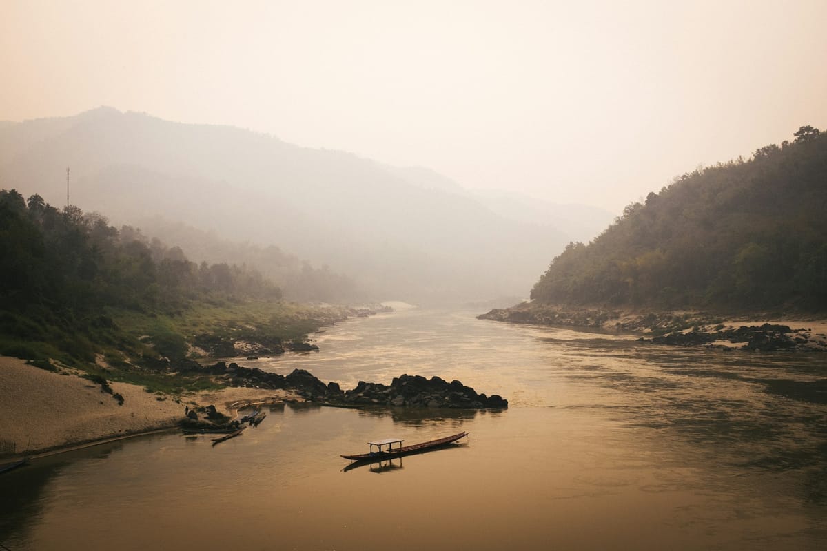
The Mekong does not recognize borders. It rises in Tibet, passes through China, then threads Laos, Myanmar, Thailand, Cambodia, and Vietnam before fanning out into one of the world’s great deltas. Borders go unrecognized by the waters, perhaps, but the river’s flow is wholly governed by politics. What happens upstream, of course, dictates downstream, and dry-season releases from upstream dams, new diversion schemes, and a warming climate all determine who plants rice, catches fish, and pays the price when saltwater creeps inland.
In a region that dislikes grand declarations and prefers quiet deals, the new language of power is, as now everywhere, measured in resources. Here, in cubic meters per second.
Upstream power, downstream costs
The imbalance is structural. China’s cascade on the Lancang, the Mekong’s upper reach, gives Beijing a very physical dimension of control over a large share of dry-season water. Laos has pursued dozens of hydropower projects as a development strategy, selling electricity to neighbors through high-voltage lines. Further downstream, Cambodia depends on the annual flood pulse to reverse the Tonlé Sap (SE Asia’s largest freshwater lake) and replenish its fisheries, while Vietnam, at the end of the line, relies on the constant pulse of fresh water to keep the salt out of the delta’s canals.
When dry-season flows are low and the sea pushes in, the costs land squarely on farmers, fisheries, and provincial budgets, not on the balance sheets of dams upstream. The Mekong River Commission, an intergovernmental organization that works to jointly manage the shared resources and development of the Mekong between the relevant nations, has warned in recent addresses that saltwater intrusion in the delta is intensifying as dry-season flows decline, a trend that narrows planting windows and raises municipal water costs. (MRC, 2025).
Laos’ hydropower bet: wires that bind
The Laotian “battery of Southeast Asia” strategy was built on the premise that hydropower revenues would be the dynamo that underwrites development project costs. The reality, however, is more complicated. This is a fluctuating system that rises and falls with the rainfall volume and regional demand, which powers revenues. Meanwhile, debt servicing and off-take contracts, where the buyer agrees to purchase a given amount of the producer’s future product, bind the country to long timelines and tight cash flow. Electrification of neighbors does create leverage, and transmission ties mean that Thailand, Vietnam, and Cambodia have a vested stake in Laotian stability, yet it also exposes Laos to price negotiations it cannot fully control.
For buyers, importing hydro can help meet green goals and displace fossil fuel use, but it creates a new dependency on upstream operations and cross-border governance. The political economy of the grid, therefore, mirrors that of the river: interdependence without equal voice.
And that would be manageable if institutions kept pace with engineering, which they have not.
Delta on the line
Vietnam’s Mekong Delta is the basin’s pressure gauge. It grows rice and fruit for the nation and the wider region, yet sits barely above sea level. Each dry season, farmers and towns must keep the salt at bay long enough to irrigate, to create conditions viable enough for growth. In 2025, authorities prepared early for another severe salinity season with sluice upgrades and rationing plans. However, the problem is not one bad year, it is the ongoing trendline. Sea levels rise and dry-season flows decline, so the salt front marches farther inland, the canals carrying brackish water where they once carried fresh, and the orchards retreat to higher ground.
The policy response has shifted from hard physical defenses alone to a more acceptant approach of managed adaptation: changing crop patterns, elevating roads and homes, and reserving brackish zones for aquaculture. The World Bank’s multi-year Mekong Delta resilience program focuses on exactly these pivots, moving the delta from reactive crisis response to climate-smart planning at basin scale, with the baseline on financing and tools for salinity management, irrigation, and land-use change (World Bank).
Canal politics: detail matters
This year’s most contentious proposal sits in Cambodia. Phnom Penh has advanced the China-backed Funan Techo Canal, a 180-kilometer link from the Mekong system to the Gulf of Thailand. While the stated goals are trade and irrigation, neighbors and river advocates worry about the hydrology. For example, if the canal diverts water in the dry season or alters flood timing, it could compound the stress on Tonlé Sap fisheries and the Vietnamese delta. The Mekong River Commission has pressed Cambodia for full feasibility studies and timely data sharing under the 1995 Mekong Agreement, including assessments of cross-border impact, while Vietnam has formally requested more information to better assess the risks.
The headline is simple, and probably familiar to anyone who follows this river: in a shared basin, project transparency is not a courtesy, it has to be the operating system. (Reuters).
Rules, transparency, and the politics of flow
Despite the challenges in cooperation, the Mekong is not lawless. The Mekong River Commission provides a forum for procedures, early notification, and technical debate, yet it is also limited. China is not a member, only a dialogue partner, and key projects have advanced with partial data and compressed timelines. Parallel frameworks for partial geographies exist, including Beijing’s Lancang–Mekong Cooperation mechanism, which funds water projects and scholarships, and ad-hoc technical exchanges that can help during floods and droughts.
The missing ‘layer’ is actually more than that. What is needed, and it’s a big proposition, is an all-seeing eye. A comprehensive, basin-wide, near-real-time visibility into what dams are doing and what that implies downstream. Civil society and research groups have tried to fill the gap, and satellite-based platforms are able to track reservoir levels and estimate natural flow versus regulated releases, giving local governments and communities a better early warning.
Tools like the Mekong Dam Monitor are, however, not a substitute for treaty-grade cooperation, even though they are a practical way to reduce uncertainty and lower the temperature when politics are heated and the river is low. (Mekong Dam Monitor).
Climate risk is now the baseline assumption
Climate change is adept at pinpointing fractures in governance capabilities, it turns every weakness into a stress test. El Niño years stretch out dry seasons, boost wildfire risk in the upper basin, and sharpen salinity intrusion at the coast. La Niña does the opposite, reminding cities how quickly floodplains can reclaim concrete and halt daily life.
The critical point here is that in either case, the common outcome of anthropogenic climate change is that the extremes are growing more frequent, something that forces harder choices.
Sure, hydropower helps decarbonize grids, but the location and operation of dams matter for food security and fish migration. Irrigation channels sustain harvests, but without careful design they can also freely channel salt and kill off fields. Canals that promise trade gains may impose ecological costs if not sequenced sensitively to basin-wide modeling.
So what progress can be seen? Well, we can see that the region’s quiet consensus is emerging in policy more than in speeches, action over words: favor projects that improve flexibility under uncertainty, invest in measurement and data sharing, and manage the river as a system rather than a list of discrete projects.
This kind of leads back to our opener: the Mekong does not recognize borders.
Why this matters beyond the basin
As we see everywhere, what happens on the Mekong does not stay there. Rice prices ripple through global markets; fish catches shape nutrition access for millions; while power-purchase agreements and cross-border transmission decide which plants run and which are retired. In a fractured global order, the basin illustrates a larger point we keep returning to in GYST: resources set the boundaries of the politically possible.
The Mekong shows how climate risk writes the first draft of policy, and how upstream decisions can become downstream leverage. It also shows that small states have agency. Cambodia can demand investment and prestige, Vietnam can insist on rigorous impact assessment, Laos can trade wires for revenue and recognition, and Thailand can use its grid as a diplomatic instrument.
The question is whether the institutions of cooperation, of inter-nation dialogue, can keep up with the physical realities of engineering and finance. If they do not, the river will continue to settle arguments on its own schedule.
Read this. Notice that. Do something.
Read this: A concise, up-to-date view from the river’s own institution on declining dry-season flows and rising salinity in Vietnam’s delta. Mekong River Commission address (Apr 2025).
Notice that: Cambodia’s Funan Techo Canal is a litmus test for basin rules: data sharing, cross-border impact, and timing. Reuters roundup on the canal debate (Apr 2025).
Do something: Track operations and flows yourself! The Mekong Dam Monitor offers near-real-time satellite-based visibility into reservoir levels and river conditions across the basin. Stimson Center project.
Previously on GYST: Pocket Power - how China is rewriting the AI rules.
Next up: Indonesia’s nickel dilemma. The EV transition’s mineral backbone and the politics of who captures the value.